Everything ArcGIS does.
Without paying licenses.
An open GIS platform with real-time editing, vector tiles, spatial analysis, compatible with all formats and backed by the world's largest open-source community.
Trusted by teams worldwide
What We Do?
Transforming traditional geospatial technology into modern, open, and scalable solutions.
ArcGIS → Open Migration
Leave expensive licenses behind. We migrate your geodatabases to PostGIS and your services to GeoServer/MapProxy.
Geo Infra on Kubernetes
Scalable and resilient deployments. We orchestrate your geospatial stack with Kubernetes and Docker for maximum availability.
Realtime Collaborative Maps
Interactive platforms where multiple users edit and visualize geographic data in real-time.
Success Stories
Powering global projects with open technology.


How We Work
A clear and structured process for your digital transformation.
ArcGIS Diagnosis
We analyze your current infrastructure, dependencies, and licensing to design the most efficient migration strategy.
Data Migration
We transfer your data to PostGIS and OpenStreetMap, ensuring topological integrity and query optimization.
Web Development
We build modern and fast interfaces using React, MapLibre, and reusable components.
K8s Deployment
Production deployment on Kubernetes to guarantee automatic scalability and high availability.
Our Products
Tools we build to solve real-world problems.
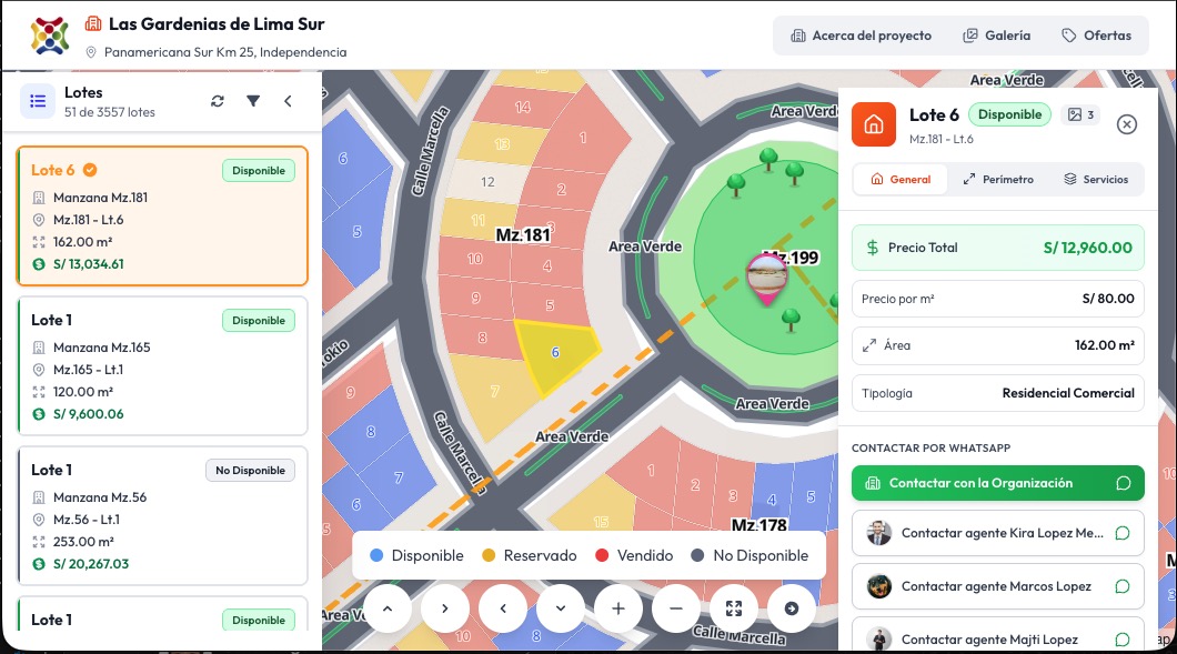
LotesPro
A comprehensive land and lot management platform for real estate developers. Visualize parcels on interactive maps, manage sales pipelines, track lot availability, and generate reports — all in one place.
Visit Site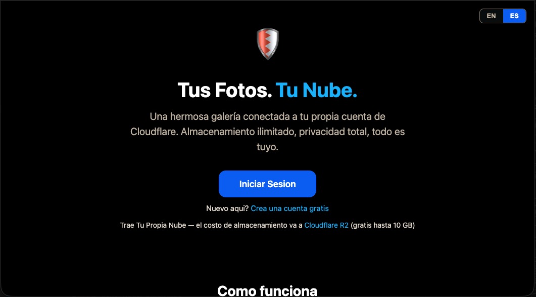
SavePics
Your photos, your cloud. A beautiful gallery connected to your own Cloudflare R2 account. Unlimited storage, total privacy — everything is yours. Free up to 10 GB.
Visit SiteLet's Talk About Your Project
Ready to modernize your geospatial infrastructure? Tell us about your challenges and let's find the best solution.
Direct Email
info@cloud4geo.comLima, Peru · Serving clients globally